
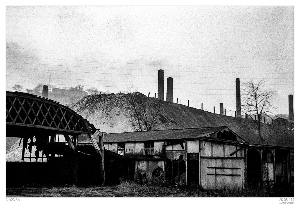
I am not quite sure where the next image on the negative strip was taken, but it must have been somewhere between Coley (Image 1) and Hipperholme (Image 3). Half demolished buildings, slag heaps, silhouetted chimneys: it’s an image of time rather than place. Hopefully someone will be able to pin down the location: all suggestions will be gratefully received.

I think the farmhouse on the skyline is still familiar. My guess is that the photograph was taken on the opposite side of the Red Beck from Sunny Vale. You couldn’t reproduce it, now because of the substantial tree growth in our lifetime. But if you walk the footpath which still exists, it passes through the remains of a substantial works. There was brick-making at Mytholm and a network of cableways carrying material from the drift mines which were used for both coal and clay mining. The straight end to the spoil heap is reminiscent of those created by tipping from overhead.
LikeLike